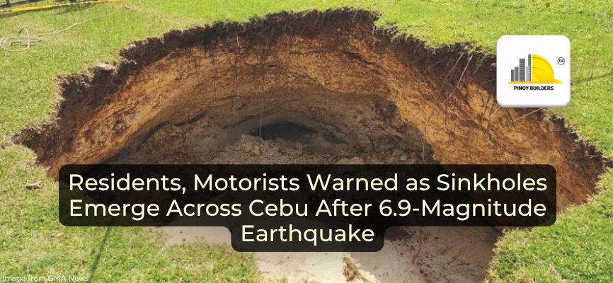
Local authorities are warning residents and motorists to stay alert as multiple sinkholes have appeared across northern Cebu following the 6.9-magnitude earthquake that struck off the coast on September 30.
At least 15 new sinkholes have been discovered in San Remigio alone, prompting evacuations in several barangays. Three families have been moved to safer areas after large cavities were found near their homes. Mayor Mariano Martinez said the number could rise in the coming days as the ground remains unstable.
“For now, we are informing the people about the sinkholes, and some people close to a sinkhole are evacuating,” he said. “Some areas still seem safe, but people really shouldn’t stay nearby. Those who were closest were the ones who evacuated because they got scared,” he added in Bisaya.
The local government is currently coordinating with the Mines and Geosciences Bureau (MGB) and the Philippine Institute of Volcanology and Seismology (Phivolcs) for continuous site monitoring.
Massive Ground Openings Reported in Maño
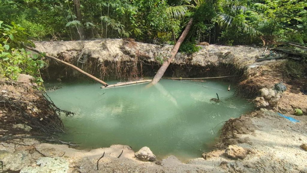
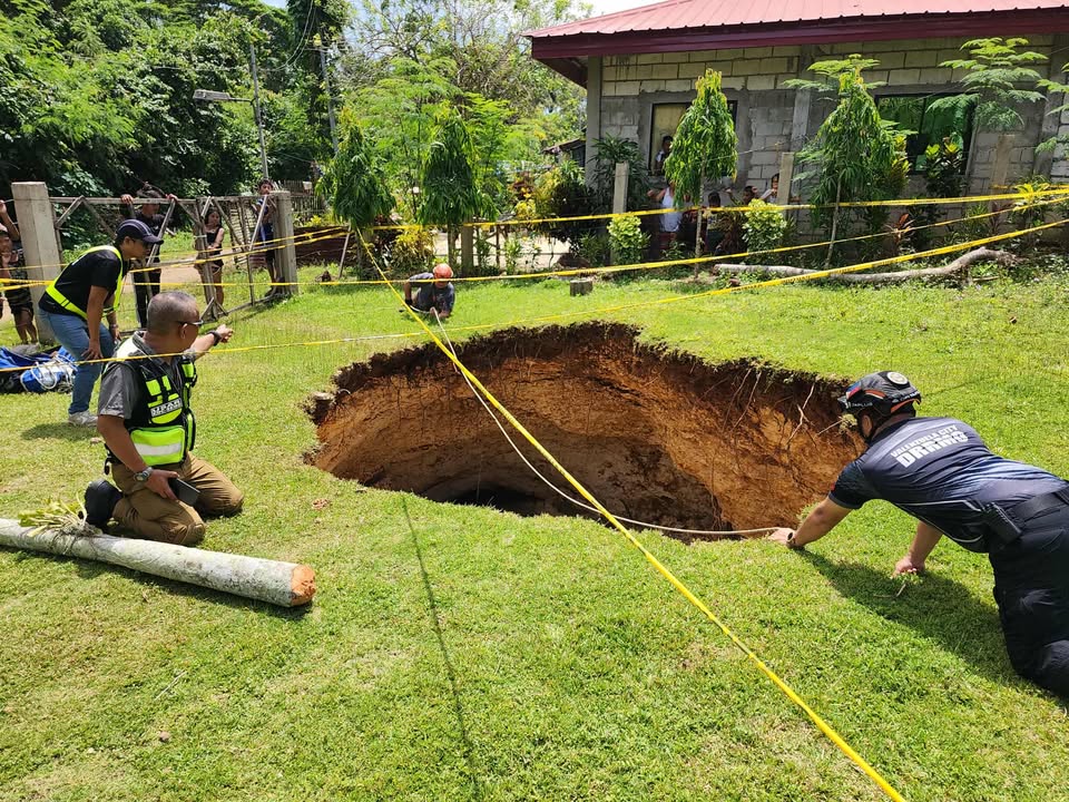
Barangay Maño was the worst hit, with several sinkholes large enough to swallow trees, boats, and even parts of houses. Residents described the earthquake as one of the strongest they had ever experienced.
One resident recalled the feeling of their house being bulldozed because of how violently the ground shook before cracks appeared on nearby roads. In one incident, a child fell into a small sinkhole but managed to climb out without injuries.
Local volunteers and disaster response teams have since cordoned off affected areas. Some sinkholes are filled with underground water, raising further concern about soil erosion and potential collapse.
Safety Measures, and Gov’t Response
Around 1,000 residents have temporarily moved to open fields due to fear of further ground movement. Many are avoiding covered courts and buildings, choosing to stay in makeshift tents instead. The local government, with help from the Department of Public Works and Highways (DPWH), is setting up a “tent city” in Barangay Cogon, Bogo City, to house displaced families.
The Department of Environment and Natural Resources (DENR) has deployed an eight-member MGB geology team to Cebu to conduct a post-disaster geohazard assessment. The study will cover San Remigio, Bogo, Daanbantayan, Tabogo n, and Medellin, which are all within the northern corridor affected by the earthquake.
According to MGB-7, the ongoing assessments aim to identify areas prone to flooding, rain-induced landslides, ground subsidence, and further sinkhole formation. Results will guide local governments in zoning, land use, and disaster-preparedness planning.
As for the residents, officials remind communities to stay alert, especially as aftershocks can still occur even days after the quake itself. Continuous monitoring and community cooperation, they said, will be key to preventing further casualties and damage.
References
Argosino, F. (n.d.). DENR sends geologists to Cebu to study flood, sinkhole risks after quake. Inquirer. https://newsinfo.inquirer.net/2120193/denr-sends-geologists-to-cebu-to-study-flood-sinkhole-risks-after-quake
Fuentes, K. J. (2025, October 4). Sinkholes swallow homes, boats in San Remigio, Cebu after magnitude 6.9 quake. The Manila Times. Retrieved October 6, 2025, from https://www.manilatimes.net/2025/10/05/news/national/sinkholes-swallow-homes-boats-in-san-remigio-cebu-after-magnitude-69-quake/2194763
Piquero, P. (2025, October 4). San Remigio sinkholes: Over 100 found, many still undiscovered. Cebu Daily News. Retrieved October 6, 2025, from https://cebudailynews.inquirer.net/661308/san-remigio-sinkholes-over-100-found-many-still-undiscovered


 Facebook
 Instagram
 Linkedin
 Twitter
 Youtube